Ferries, gravel and real travel times, step by step. And everything beyond, all the way to Villa O'Higgins.
The Carretera Austral is one of the world's great road journeys: fjords crossed by ferry, temperate rainforest, glaciers hanging above the road and villages that, forty years ago, could only be reached by sea. This guide covers the whole route, from Puerto Montt to Villa O'Higgins, with a special focus on the northern section and the detour to Futaleufú, home of Uman Lodge. Distances, schedules and road conditions were checked against official sources in October 2026.
Length (Chile's Ministry of Public Works)
~1,058 km
Paved
58%
Puerto Montt–Futaleufú, plus 2 ferries
~320 km
Esquel airport–Uman Lodge
98 km
The route
Route 7, the backbone of Chilean Patagonia
The Carretera Austral ("Southern Highway") is the popular name for Chile's Route 7, officially the Camino Longitudinal Austral. It starts in Puerto Montt, in the Los Lagos Region, and ends in Villa O'Higgins, in the Aysén Region, near the Southern Patagonian Ice Field. Until a few decades ago, the villages along it depended on the sea, or on Argentina, to reach the rest of Chile.
How long is it? It depends on how you measure it. In April 2026, Chile's Ministry of Public Works (MOP) put it at about 1,058 km (660 miles) from Puerto Montt to Villa O'Higgins. Historical sources and most guidebooks quote about 1,240 km (770 miles), and some measure 1,247 km from the Manuel Montt lookout to Puerto Bahamondes, 8 km south of Villa O'Higgins. The difference comes down to start and end points, side roads and ferry sections. For planning purposes, think of just over a thousand kilometers of road and three or four water crossings.
How much is paved? According to the same MOP report, 614.5 km are paved (58%) and 443.5 km are still gravel (ripio, in Chile). The 2026–2030 "Ruta Austral" plan aims to pave another 150.4 km. In practice, almost everything between Chaitén and Coyhaique is now asphalt, while gravel dominates south of Villa Cerro Castillo.
Futaleufú is not on Route 7 itself but 76 km (47 miles) east of it, in the valley of the river of the same name. It is the best-known detour on the northern section and the point where the Carretera Austral comes closest to Argentina: the Futaleufú border crossing is only minutes from town.
A young road
History: from 1976 to Villa O'Higgins
Until the 1970s, most of Chilean Patagonia had no road link with the rest of the country. Driving from Puerto Montt to Coyhaique meant crossing into Argentina. In March 1976, final studies were commissioned from the Chilean Army's Military Work Corps and the MOP's Roads Directorate. By August that year the plan had been approved, already including three mandatory sea crossings.
Construction advanced in stages and in extreme conditions. Between 1976 and 1982 some 420 km were opened between Chaitén and Coyhaique. By 1988 another 140 km and three ferries across the fjords had been added. More than 10,000 soldiers worked on the project. The road opened to traffic in 1988, reached Puerto Yungay in 1996 and Villa O'Higgins in 2000. The branch to Caleta Tortel was completed in 2003.
It is one of the most ambitious public works of 20th-century Chile, and it is still unfinished: paving continues, and an extension toward Magallanes is under study. During the dictatorship, maps and signs used the name "Carretera Longitudinal Austral Presidente Pinochet", but no official document ever backed it. Its official name is Route 7.
Gateways
How to get to the Carretera Austral
There are four practical ways to start. Which one suits you depends on your time and on whether you want to drive the whole road or just part of it.
Fly from Santiago to Puerto Montt. The classic gateway. There are frequent direct flights to El Tepual airport, where you can rent a car and head south on Route 7, or connect to a light aircraft to Chaitén.
Fly to Balmaceda (Coyhaique). Useful for starting or ending mid-route. The airport is 56 km from Coyhaique.
From Chiloé. Naviera Austral ferries link Castro and Quellón with Chaitén, the natural option if you are touring the island first.
From Argentina. Fly to Esquel, drive through Trevelin and cross the Futaleufú Pass straight into the valley, with no ferries at all. See below.
Before you fly in: check visa requirements for your nationality. On arrival, Chile's immigration police (PDI) give you an entry slip: keep it for the whole trip. Foreign tourists paying in US dollars need it to be exempt from Chile's 19% VAT at hotels such as Uman Lodge. Car rental companies ask for your national license, and many recommend an International Driving Permit.
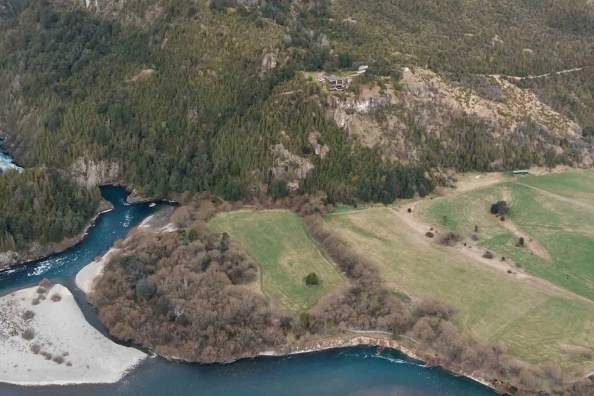
The confluence of the Espolón and Futaleufú rivers, at the end of the detour.
By road and ferry
Stage by stage: Puerto Montt to Futaleufú
This is the route most travelers look for, and the most beautiful in the north. It adds up to about 320 km (200 miles) of road plus two ferry crossings: the short one at Caleta La Arena and the bimodal route between Hornopirén and Caleta Gonzalo. Allow a full day, 12 to 14 hours with waiting times, or better still two days, overnighting in Hornopirén or Chaitén.
Puerto Montt → Caleta La Arena
45 km · paved
Route 7 along the Reloncaví Sound to the first ferry ramp.
Caleta La Arena → Caleta Puelche
Ferry · 30–45 min
Runs 24 hours a day, no booking, first come, first served. Expect queues in summer, on weekends and on public holidays.
Caleta Puelche → Hornopirén
Paved
To the port of the bimodal route. From Puerto Montt it is about 106 km of road, roughly 2 hours, plus the crossing.
Hornopirén → Caleta Gonzalo
Bimodal route · ~4.5 h
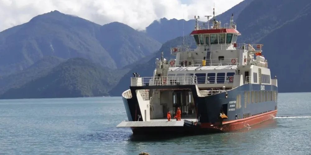
Two linked ferries through the Comau and Reñihue fjords, with 10 km of gravel between Leptepu and Fiordo Largo, sold as a single fare. With a vehicle, booking is mandatory.
Caleta Gonzalo → Chaitén
56 km · gravel · ~1.5 h
Through Pumalín Douglas Tompkins National Park, among alerce trees, waterfalls and the Chaitén volcano.
Chaitén → Villa Santa Lucía
75 km · paved · ~1.5 h
Past El Amarillo and along Lake Yelcho.
Villa Santa Lucía → Futaleufú
76 km · ~20% paved · ~1 h 40
Leave Route 7 heading east on Route 235-CH to Puerto Ramírez, then Route 231-CH up the Futaleufú valley. Paving is advancing in stages.
Distance from Puerto Montt to Futaleufú: about 320 km of road via the Carretera Austral, including the 10 km of gravel inside the bimodal route, plus the ferry crossings. Via Argentina it is about 680 km, with no ferries but two border posts.
Can you drive it in a day? Yes, if you catch the 10:00 ferry from Hornopirén: leave Puerto Montt before 7:00 and you reach Futaleufú by sunset. On the 18:00 sailing you land at Caleta Gonzalo after dark, and the sensible move is to overnight in Chaitén. The gravel through Pumalín is not a road to drive in a hurry or at night.
The last stretch to Uman. The lodge sits on Fundo La Confluencia, a few minutes from town. The access road is gravel with steep sections: a 4x4 or pickup is ideal, and in a regular car you should drive up with care.
Other ways in
Skipping the bimodal route
If the Hornopirén ferry is full, or you would rather not drive, there are alternatives.
Overnight ferry
Puerto Montt → Chaitén
9 h
Naviera Austral sails from Angelmó, stopping at Ayacara. As of October 2026 it departs at 23:00 Tuesday to Saturday and at 12:00 on Mondays. You sleep on board and reach Chaitén in the morning, with your car.
Light aircraft
Puerto Montt → Chaitén or Futaleufú
~45 min
Pewen and Aerocord fly from Puerto Montt's La Paloma airfield (not El Tepual) to Santa Bárbara airfield near Chaitén. Aerocord also runs charters to the Futaleufú airfield, 3 km from the lodge.
Bus
Puerto Montt → Chaitén → Futaleufú
1–2 days
Kemel Bus covers Puerto Montt–Chaitén via the bimodal route, with a connection to Futaleufú. Buses between Chaitén and Futaleufú take about 3 hours.
From Chiloé, Naviera Austral sails Castro–Chaitén (about 6 hours, currently Sundays only) and Quellón–Chaitén (about 6.5 hours, January to March only). When the bimodal route is full, another option is Pichicolo–Ayacara–Caleta Gonzalo, run by Transportes Puelche, which does not operate daily.
Private transfers. Uman Lodge arranges transfers from the Futaleufú airfield, Chaitén or Esquel. They are not included in the rate and must be requested at least 48 hours in advance.
By water
Ferries: schedules and bookings
On the Carretera Austral you plan around sailings, not the other way round. This table summarizes the crossings you will meet from north to south, using operators' information as of October 2026.
Crossing
Operator
Duration
Booking
Caleta La Arena – Caleta Puelche
Transportes del Estuario
30–45 min
No. 24 hours, first come, first served
Hornopirén – Caleta Gonzalo (bimodal)
Somarco
~4.5 h including the land stretch
Yes, mandatory with a vehicle (barcazas.cl)
Puerto Montt – Chaitén
Naviera Austral
~9 h
Yes, recommended
Castro or Quellón – Chaitén
Naviera Austral
6–6.5 h
Yes. Limited, seasonal sailings
Puerto Ibáñez – Chile Chico
Naviera Austral
~2 h
Yes, in summer
Puerto Yungay – Río Bravo
Free service
~50 min
No, first come, first served
How the bimodal route works. From Hornopirén you sail about 3.5 hours (34 nautical miles) to Leptepu, drive 10 km of gravel to Fiordo Largo and cross in 40–45 minutes to Caleta Gonzalo. There are currently two subsidized sailings a day in each direction: 10:00 and 18:00 from Hornopirén, and 12:30 and 20:00 from Caleta Gonzalo. An extra commercial sailing is added in January. The last departure from Caleta Gonzalo may change with the tide.
Reference fares, Puerto Montt–Chaitén ferry (Naviera Austral, commercial fare for foreigners, one way, October 2026): from CLP 43,300 per passenger and from CLP 210,000 per car. The subsidized Tuesday, Thursday and Friday sailings are cheaper.
Booking tips:
For January and February, book the bimodal route as soon as you have dates. Vehicle spaces sell out first.
Declare your vehicle's exact dimensions, including roof boxes and bike racks. If they don't match, you may be left on the dock.
Leave a margin: there can be a queue at La Arena, and missing the 10:00 bimodal sailing changes your whole day.
Sailings are cancelled in strong wind or swell. Keep a spare day before any flight home.
From Argentina: Esquel, Trevelin and the Futaleufú Pass
For many travelers, the best gateway to the northern Carretera Austral is not in Chile. Aerolíneas Argentinas flies direct from Buenos Aires (Aeroparque) to Esquel in about 2.5 hours. From the airport to Uman Lodge it is 98 km (61 miles), through Trevelin and the Río Futaleufú international pass. It is the shortest route to the lodge, it does not depend on ferries, and you can be in the valley by lunchtime.
The road. Esquel to Trevelin is paved. From Trevelin, Argentina's Route 259 continues toward the Andes; between Los Cipreses and the border it is gravel, and in September 2026 the national roads agency was grading it, with a 60 km/h speed limit. On the Chilean side, Futaleufú town is about 10 km from the border.
The border post. The El Límite–Futaleufú complex is open 08:00–19:00 for private cars and buses. Hours can change in winter or in emergencies: check the day before at pasosfronterizos.gov.cl.
What to bring:
A valid passport. On entering Chile, keep the PDI entry slip: you will need it for the VAT exemption.
If you drive your own car: its registration and insurance valid in Chile.
If the car is rented: written authorization from the rental company to leave the country, plus insurance valid in both countries. Argentine companies issue a Mercosur circulation authorization (ACM); in Chile, the rental company processes a temporary-exit permit with Customs. Request it when you book, as it can take days and carries a fee.
Do not bring fresh fruit, vegetables, meat, dairy or seeds into Chile without declaring them. The SAG agricultural inspection is strict and fines are high.
Bariloche is also connected to Esquel by road, via Route 40 and El Bolsón. Combining Bariloche, Esquel, Futaleufú and the northern Carretera Austral makes one of the most complete two-country loops in Patagonia.
The whole route
The Carretera Austral from north to south
From Villa Santa Lucía, Route 7 continues south through some of the most untouched landscapes in South America. Use these section distances and road surfaces as a planning reference.
Section
Distance
Surface
Approx. time
Puerto Montt – Hornopirén
106 km
Paved + La Arena ferry
2 h + crossing
Caleta Gonzalo – Chaitén
56 km
Gravel
1.5 h
Chaitén – Villa Santa Lucía
75 km
Paved
1.5 h
Villa Santa Lucía – Futaleufú (detour)
76 km
~20% paved
1 h 40
Villa Santa Lucía – La Junta
69 km
Paved
1 h 20
La Junta – Puyuhuapi
45 km
Paved
55 min
Puyuhuapi – Coyhaique
233 km
~90% paved
4 h 40
Coyhaique – Villa Cerro Castillo
96 km
Paved
2 h
Villa Cerro Castillo – Puerto Río Tranquilo
123 km
Mostly gravel
2 h 50
Puerto Río Tranquilo – Cochrane
115 km
Gravel
3 h
Cochrane – Caleta Tortel
126 km
Gravel
3 h 20
Cochrane – Villa O'Higgins
231 km
Gravel + Yungay–Río Bravo ferry
6 h + crossing
Times without stops, at 38–50 km/h (24–31 mph). On gravel, in rain or with roadworks, add 20–30%.
Current conditions. The north is almost entirely paved between Chaitén and Coyhaique, with some gravel and roadworks. From Villa Cerro Castillo south, gravel is the rule, and there is active work between Confluencia and Puente Chacabuco near Cochrane. For daily closures, landslides and detours, check the MOP Roads Directorate notices before each stage.
The whole route, Puerto Montt to Villa O'Higgins.
Northern section in detail. Indicative diagram, not for navigation.
Stops from north to south
Puerto Montt: start of Route 7.
Caleta La Arena – Caleta Puelche: first ferry.
Hornopirén – Caleta Gonzalo: bimodal route.
Chaitén and Pumalín Park.
El Amarillo: hot springs.
Villa Santa Lucía: turnoff to Futaleufú (76 km) and the Futaleufú Pass, toward Trevelin and Esquel.
La Junta and Puyuhuapi.
Queulat: Hanging Glacier.
Coyhaique (Balmaceda airport).
Villa Cerro Castillo.
Puerto Río Tranquilo: Marble Caves.
Cochrane and the spur to Caleta Tortel.
Puerto Yungay – Río Bravo: ferry.
Villa O'Higgins: end of the road.
Worth the detour
Highlights along the way
Pumalín Douglas Tompkins National Park
Created in 2018, it covers some 402,000 hectares, most of them donated by Tompkins Conservation. Between Caleta Gonzalo and Chaitén, the road runs through ancient alerce forests with short, well-marked trails. The best known climbs to the crater rim of the Chaitén volcano: 4.4 km round trip, about 2.5 hours, moderately hard. There is a direct link with Uman: Fundo La Confluencia, where the lodge stands, was bought from Douglas Tompkins in 2007.
Chaitén
The town the volcano buried in ash in 2008, and which rebuilt itself. Today it is the northern logistics hub, with ferries, an airfield, fuel, a bank and shops. Its waterfront on the Gulf of Corcovado has some of the widest views on the route.
El Amarillo Hot Springs and Lake Yelcho
About 25 km south of Chaitén, a short gravel turnoff leads to the El Amarillo hot springs, fed by water from the Michinmahuida volcano at around 50 °C. Further on, the road skirts Lake Yelcho, vast and blue, where the Futaleufú River ends its run.
Futaleufú
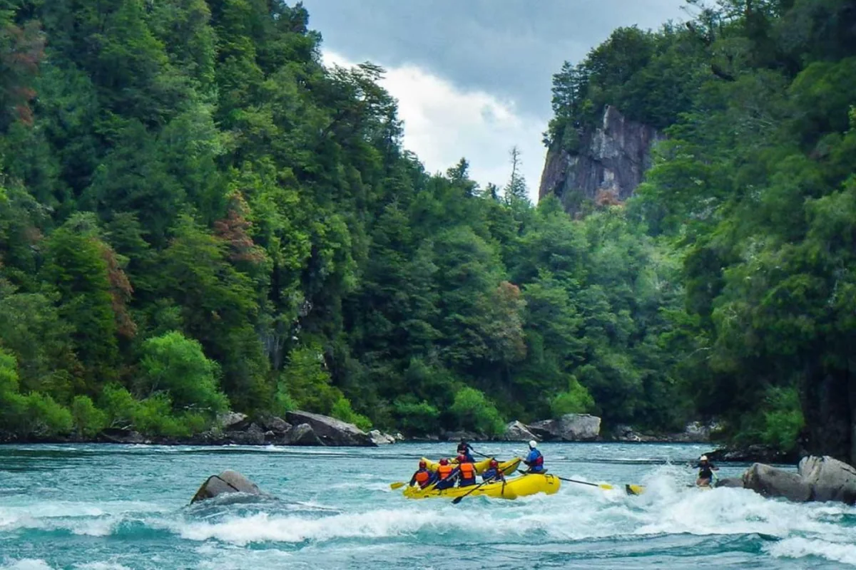
The town sits about 10 km from the border, ringed by mountains and two turquoise rivers. Kayakers and rafters know the river worldwide for its clear water and class IV–V rapids: read our guide to rafting the Futaleufú. The valley is also great for fly fishing, horseback riding, hiking and mountain biking.
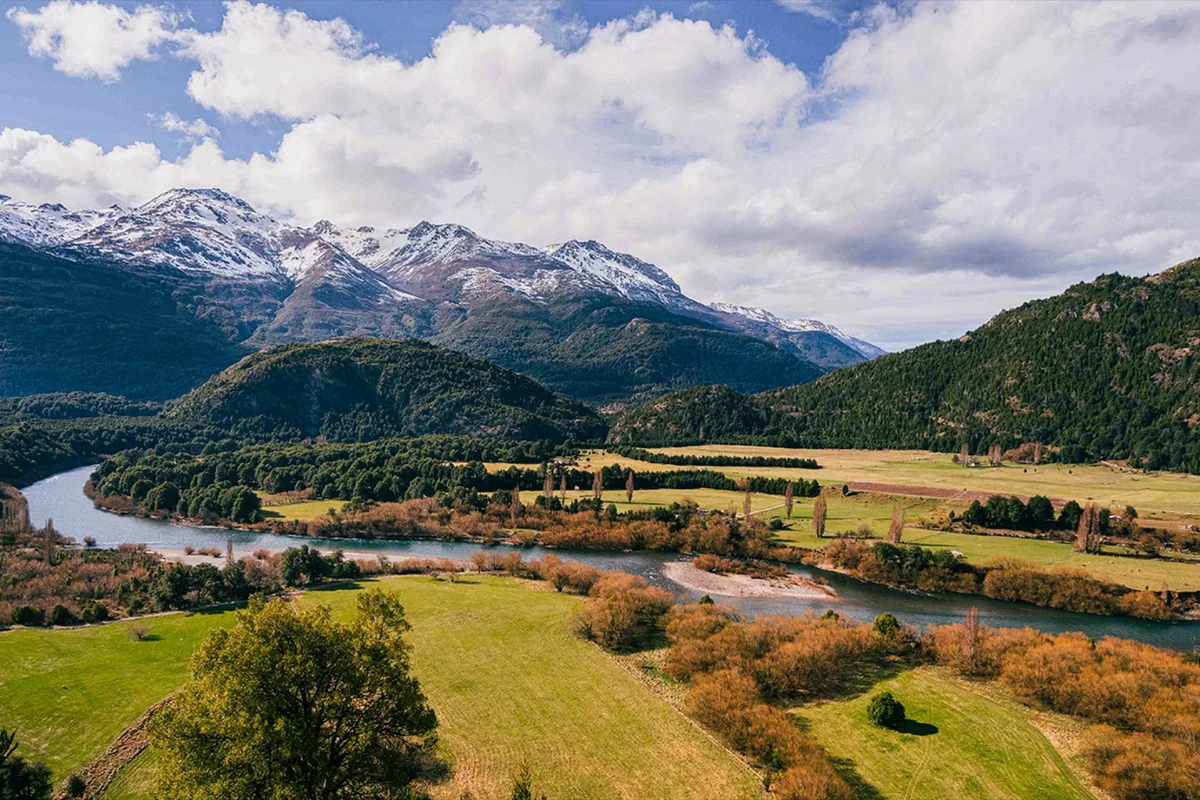
The Futaleufú valley from Fundo La Confluencia.
Puyuhuapi and Queulat National Park
Puyuhuapi was founded in 1935 by German settlers from the Sudetenland, at the head of a fjord. Six km south, on the same road, are the Termas Ventisquero hot springs, with outdoor pools facing the water. About 20 km south of Puyuhuapi lies the Ventisquero sector of Queulat National Park: the trail to the Hanging Glacier lookout is 3.3 km round trip, 2–3 hours, and ends in front of a glacier spilling over a rock wall.
Coyhaique
Aysén's capital and the only real city on the route. The place to rest, refuel and get cash before heading south.
Cerro Castillo
The basalt spires of Cerro Castillo tower over the Ibáñez valley. The trail to the Laguna Cerro Castillo lookout starts 4 km from the village: 13 km round trip, about 7 hours and 1,122 m of elevation gain, with entry only between 08:00 and 12:00. Check the park's entry requirements before you go.
Lake General Carrera and the Marble Caves
South America's second-largest lake, shared with Argentina. Boats leave Puerto Río Tranquilo for the Marble Caves (Capillas de Mármol), a nature sanctuary of water-carved caverns. The classic trip takes about 1.5 hours, and the lake is calmest early in the morning.
Caleta Tortel
A village with no streets for cars, a protected heritage zone linked by kilometers of cypress boardwalks between forest and water, near the mouth of the Baker River. You leave the car at the parking area at the entrance.
Villa O'Higgins
The end of the road, reached after the free Puerto Yungay–Río Bravo ferry. Between November and March you can continue to El Chaltén, Argentina, by boat and on foot or by bike via Lago del Desierto: a crossing for travelers without a car.
Hot water
Hot springs near Futaleufú
It is one of the most common searches in the area, so let's be clear: there are no natural hot springs in Futaleufú town. The closest along the route are:
El Amarillo Hot Springs, about 120 km from Futaleufú and 25–30 km from Chaitén, on the edge of Pumalín Park. Open all year and easy to add on the way in or out.
Termas Ventisquero, at Puyuhuapi, about 195 km from Futaleufú. Right on Route 7, open all year, with an evening session in January and February.
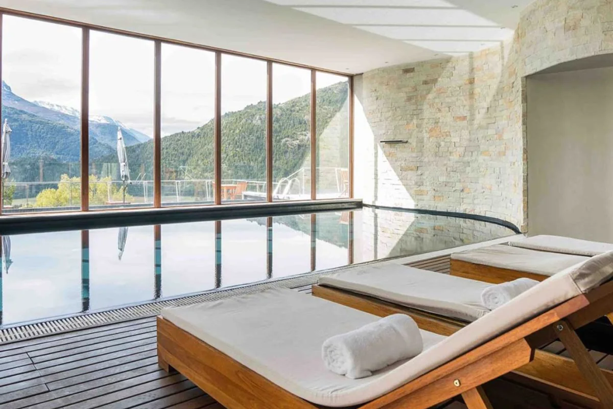
If what you want is hot water after a day on the river, Uman Lodge's spa has a heated indoor pool with windows onto the mountains, an outdoor hot tub facing the valley, a dry sauna, a hammam and a massage room. It is not a natural hot spring, but it is the most comfortable way to end a day of rafting or riding.
The heated pool at the Uman Lodge spa.
Season
When to go
The travel season runs from November to April. Outside it, ferries run less often, many services close and frost makes gravel harder.
Period
What it's like
Best for
November – mid-December
Spring: high rivers, forest in bloom, long days and fewer people. Cooler and changeable
Travelers seeking quiet and good rates
Late December – February
High summer: warmest and longest days. Peak season, with full ferries and lodgings
Families, and anyone with bookings made
March
Often more stable weather, less wind, first autumn colors
The best balance for many travelers
April
Deep autumn and few visitors. Shorter days, some services already closed
Photographers and flexible travelers
It rains in every month, especially in the northern fjords (Hornopirén, Chaitén, Puyuhuapi). The south, toward Cochrane, is drier but windier. Uman Lodge is open from 7 November 2026 to 31 March 2027.
Before you go
Driving on gravel
Don't trust the map
On gravel you average 40–50 km/h (25–30 mph), and app travel times almost always fall short. Plan to arrive before dark: tight bends, narrow stretches, little signage and animals on the road.
Vehicle
You don't need a 4x4 for Route 7, but you do want high clearance, good suspension and a sound spare tire (ideally two for the far south). For the drive up to Uman, a 4x4 or pickup is best. Slow down when passing other vehicles: flying stones crack windshields.
Car rental and one-way fees
Most rental companies in Puerto Montt and Balmaceda charge an extra fee to drop the car in another city, and it can be high. Compare a round trip with a one-way drive plus a flight. Also check that the contract allows gravel roads and ferries.
Fuel
There are Copec stations in Chaitén, Futaleufú and La Junta, plus Coyhaique and Cochrane further south. Supply in Puyuhuapi is limited. The rule is simple: fill up whenever you can. For the far south, between Cochrane and Villa O'Higgins, carry a jerrycan.
Cash
There are BancoEstado branches in Chaitén and Futaleufú, but ATMs can run dry in high season. Small shops, campsites, boats and some ferries do not always take cards. Uman is the opposite: payment is by card only, and cash is not accepted.
Connectivity
There are long stretches without mobile coverage between towns. Download offline maps, share your itinerary with someone and don't rely on your phone's GPS in the south.
Insurance and crossing to Argentina
If you plan to combine the trip with Argentina, ask for the exit authorization when you book the car. Without it, you cannot cross at Futaleufú. Check what the insurance covers on gravel, on ferries and in the other country.
7, 10 and 14 days
Suggested itineraries
Three ways to travel the road, all within Uman's season (November to March) and with Futaleufú as a base or a stop. They are paced comfortably: you can shorten them, but we don't recommend squeezing the ferry days.
7 days: the northern Carretera Austral, based in Futaleufú
Puerto Montt – Hornopirén. Fly into Puerto Montt, pick up the car and drive 106 km, with the La Arena crossing. Overnight in Hornopirén so you can take the morning ferry without stress.
Bimodal route – Chaitén. The 10:00 ferry, Caleta Gonzalo and the Pumalín trails. Overnight in Chaitén.
Chaitén – Futaleufú. Hike to the Chaitén crater early, stop at El Amarillo Hot Springs and follow Lake Yelcho to Uman Lodge.
Futaleufú: the river. Raft the section of your choice, or a gentle float on the Espolón if you are traveling with children.
Futaleufú: the valley. Fly fishing, a horseback ride or a hike in the Futaleufú Reserve, then the spa.
Futaleufú at your own pace. Kayaking, biking or simply the terrace above the confluence.
Departure. Drive back to Chaitén for the ferry or a flight to Puerto Montt, or cross to Esquel if your car and flights allow.
Rafting the Futaleufú, the main reason to stay several days.
Via Argentina: fly to Esquel, cross to Futaleufú in a morning and stay 5 nights at Uman, with a full-day outing to Lake Yelcho and El Amarillo Hot Springs.
10 days: Puerto Montt to Coyhaique
Puerto Montt – Hornopirén.
Bimodal route – Caleta Gonzalo – Chaitén.
Chaitén – El Amarillo Hot Springs – Lake Yelcho – Futaleufú.
Futaleufú: rafting.
Futaleufú: fly fishing or horseback riding.
Futaleufú: hiking, biking and the spa.
Futaleufú – La Junta – Puyuhuapi (about 190 km). Termas Ventisquero in the afternoon.
Queulat National Park. The Hanging Glacier trail and the climb over the Queulat pass.
Puyuhuapi – Coyhaique (233 km), through the Cisnes River valley and Mañihuales.
Fly out of Balmaceda. If you rented the car in Puerto Montt, factor in the one-way fee.
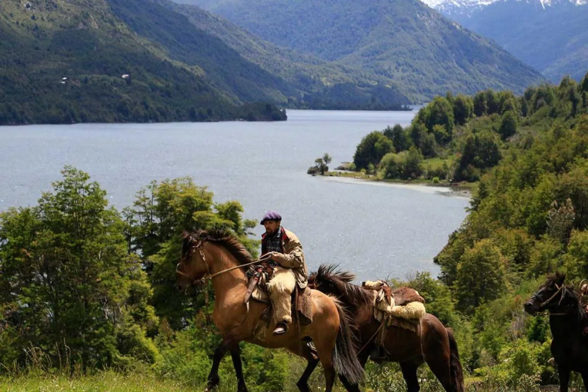
Riding between lakes, one of the outings from Uman.
14 days: to the Marble Caves
Days 1–9 as in the 10-day itinerary. Then:
Coyhaique – Villa Cerro Castillo (96 km). Free afternoon and the Paredón de las Manos, with Tehuelche rock art.
Hike to the Laguna Cerro Castillo lookout. About 7 hours: start early.
Villa Cerro Castillo – Puerto Río Tranquilo (123 km of gravel) along Lake General Carrera.
Marble Caves by boat first thing, then head back north.
Fly out of Balmaceda.
With more time: add 4–5 days for Cochrane, Caleta Tortel and Villa O'Higgins, and return the same way or cross to Argentina via Chile Chico.
How to travel
By car, by bike or on a tour?
By car is the most flexible option and the one most travelers choose. You can stop at every viewpoint, but you need to plan ferries, fuel and distances. A 4x4 pickup makes everything easier, especially in the south and on side roads.
By bike, the Carretera Austral is a world-class touring classic. It is demanding: long gravel stretches, wind, rain and climbs such as the Queulat pass. Ferries carry bikes at their own fare. If you'd like a taste of gravel without panniers, Uman has mountain bikes and e-bikes for exploring the valley roads.
On a tour or package, you hand over the logistics: transfers, ferries, guides and lodging. In Futaleufú, Uman's Full Experience program includes lodging, all meals and one excursion per person per day, so the most active part of your trip needs no planning.
By bus or motorbike is possible too. Buses are slow and depend on ferry times; motorbikes call for a dual-sport model and experience on loose gravel.
Lodging
Where to stay along the route
Options range from campsites and family guesthouses to cabins and a handful of lodges. In the towns along the way (Hornopirén, Chaitén, La Junta, Puyuhuapi, Coyhaique, Puerto Río Tranquilo) one night is usually enough; in January and February, book early, as small towns fill up fast.
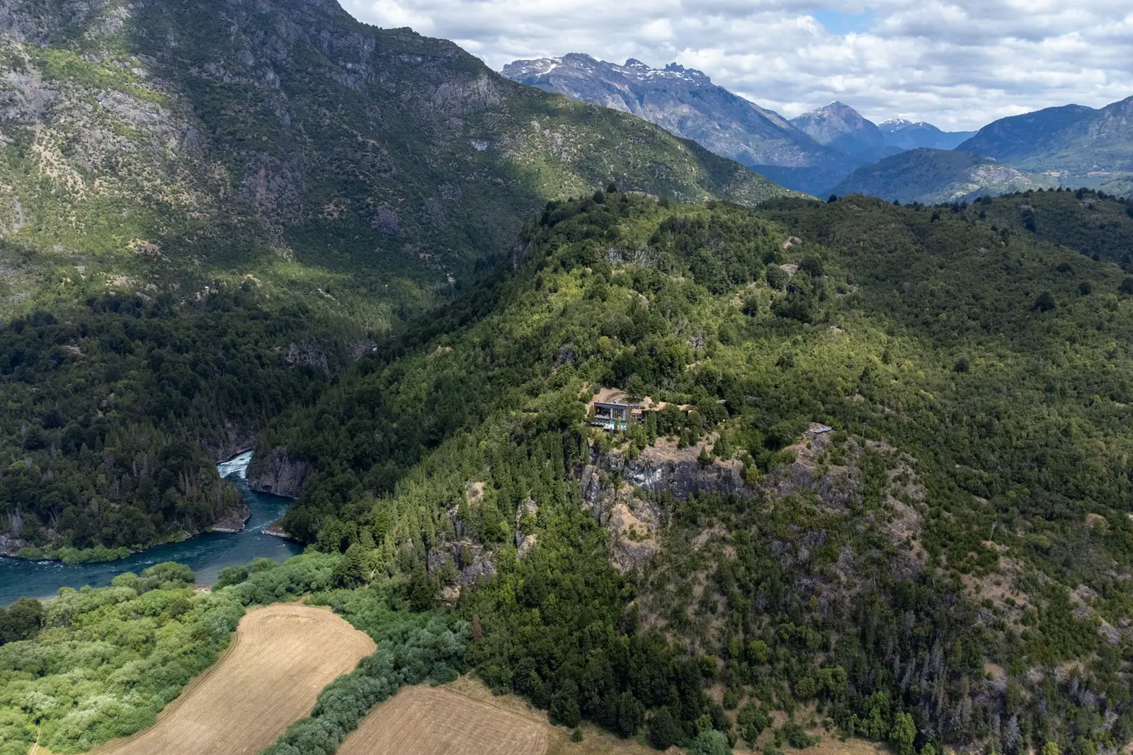
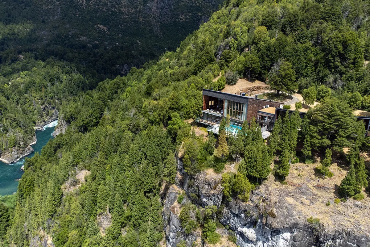
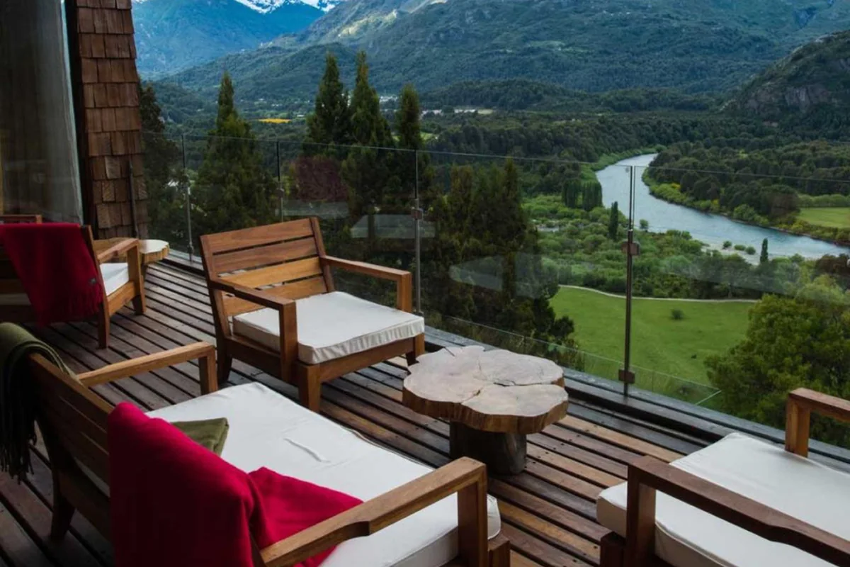
In Futaleufú, Uman Lodge. It stands on a cliff above the confluence of the Espolón and Futaleufú rivers, on a 490-hectare estate with an organic garden, livestock and a private river beach. It has 16 suites with mountain views, a restaurant using produce from its own farm, a wine cellar, a bar and a spa. It is the natural place for a multi-night stay on the northern section, where the road trip turns into river, fishing, horses and mountains.
Buffet breakfast, Health Club access and parking included. Add half board, full board or the Full Experience.
Activities from the lodge: rafting, fly fishing, horseback riding, hiking, kayaking, mountain biking and spa.
Rates in US dollars per room per night. Foreign tourists paying in dollars are exempt from VAT on presenting their PDI entry slip.
Uman Lodge, above the confluence of the Espolón and Futaleufú rivers.
Common questions
FAQ
How long is the Carretera Austral?
According to Chile's Ministry of Public Works, about 1,058 km (660 miles) between Puerto Montt and Villa O'Higgins, 58% of it paved (April 2026). Many guidebooks and historical sources quote 1,240 km, because they include side roads and measure from other points.
Where does the Carretera Austral start and end?
It starts in Puerto Montt, in the Los Lagos Region, and ends at Villa O'Higgins (Puerto Bahamondes), in the Aysén Region, on Lake O'Higgins. Beyond that you can only continue to Argentina by boat and on foot or by bike.
What is the official name of the Carretera Austral?
Route 7, or Camino Longitudinal Austral. The name "Presidente Pinochet" appeared on signs and maps during the dictatorship, but it was never official.
Is Futaleufú on the Carretera Austral?
Not exactly. Futaleufú is 76 km off Route 7: the turnoff is at Villa Santa Lucía, heading east on Routes 235-CH and 231-CH toward the Argentine border.
How far is it from Puerto Montt to Futaleufú?
About 320 km (200 miles) of road via the Carretera Austral, plus two ferry crossings: Caleta La Arena–Caleta Puelche and the Hornopirén–Caleta Gonzalo bimodal route. Via Argentina, with no ferries, it is about 680 km.
How long does it take to drive from Puerto Montt to Futaleufú?
A full day: 12 to 14 hours with ferries and waiting times, if you take the 10:00 bimodal sailing. It is more comfortable over two days, overnighting in Hornopirén or Chaitén.
How do I fly to Futaleufú from Santiago?
Fly Santiago–Puerto Montt (El Tepual) and transfer to La Paloma airfield, where Pewen and Aerocord fly to Chaitén. Aerocord also offers charters to the Futaleufú airfield, 3 km from Uman Lodge. From Argentina, fly Buenos Aires–Esquel, 98 km from the lodge.
Do I need to book the ferries?
Not the Caleta La Arena–Caleta Puelche crossing, which runs 24 hours on a first-come, first-served basis. The Hornopirén–Caleta Gonzalo bimodal route requires booking with a vehicle, and the Puerto Montt–Chaitén ferry is worth booking, especially in January and February.
Do I need a 4x4?
Not for Route 7, but you do want high clearance and good suspension. On gravel, a reasonable speed is 40–50 km/h. The access road to Uman Lodge is steep gravel: a 4x4 is recommended there, and in a regular car you should drive with care.
Can I get to Futaleufú from Argentina?
Yes, and it is the shortest route to the lodge. From Esquel, drive through Trevelin on Route 259 to the Futaleufú Pass, open 08:00–19:00. If the car is rented, you need the rental company's authorization to cross.
Are there hot springs near Futaleufú?
Not in town. The closest are El Amarillo Hot Springs, about 120 km away near Chaitén, and Termas Ventisquero at Puyuhuapi. At Uman Lodge, the spa has a heated pool, an outdoor hot tub, a sauna and a hammam.
When is the best time to drive the Carretera Austral?
November to April. January and February have the longest days but also the most people and the fullest ferries. November and March usually offer the best balance of weather, quiet and availability.
At the end of the detour
A stop in Futaleufú
Uman Lodge sits above the confluence of the Espolón and Futaleufú rivers, a few minutes from town. After a day of gravel and ferries, it is the place to stay several nights before heading south to La Junta, Puyuhuapi and Queulat, or crossing into Argentina. Send us your dates and we'll help you plan the northern section.